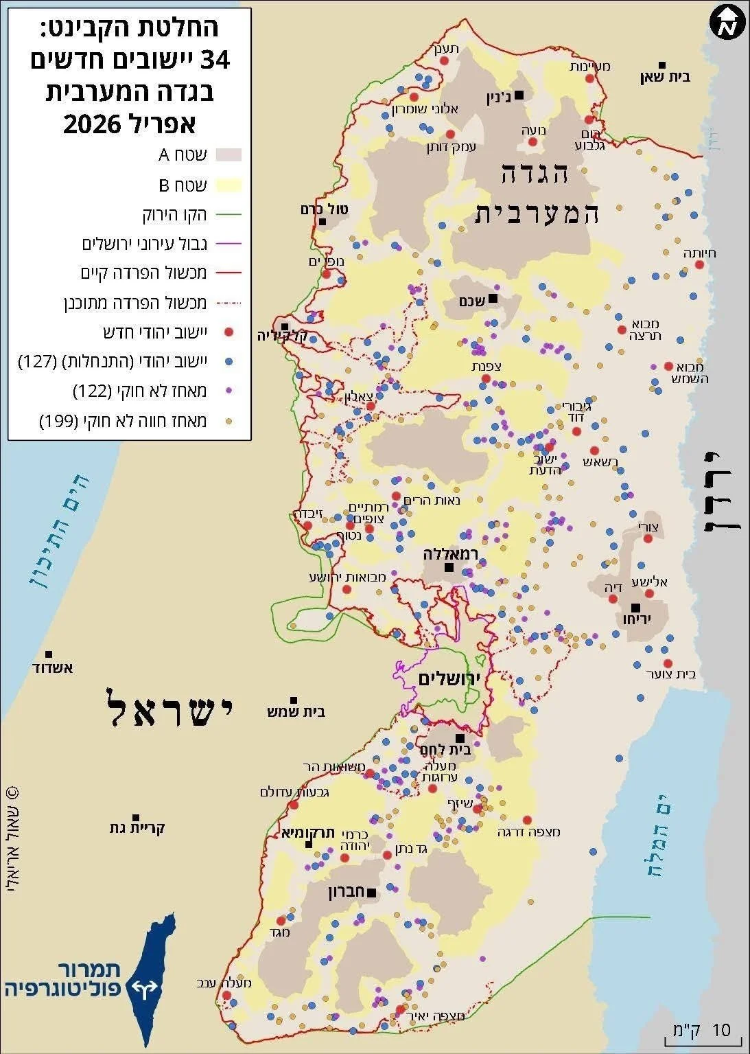
No source provided other than the copyright in the name of Shaul Arielli (in Hebrew) on the map. Here is a link about him:https://www.shaularieli.com/en/about-shaul-arieli/
Updated Map of Israeli Settlements in the West Bank through 2026.
Beyond the long-outdated A, B, and C classifications, which no longer reflect the reality, this map illustrates the actual structure of territorial control:
* 34 new settlements: representing a deliberate strategy to establish irreversible facts on the ground.
* 127 existing settlements: forming the backbone of the settlement system, increasingly treated as a de facto reality.
• 122 unauthorized outposts: technically illegal under Israeli law, but in practice integrated into the broader settlement enterprise.
* 199 unauthorized settlement farms: gradually expanding territorial control under the guise of agricultural and grazing activity.
Notably, activities labeled as “illegal” within the Israeli legal framework often function as key instruments of expansion on the ground, frequently developed, protected, and allowed to expand, including through groups such as the so-called “Hilltop Youth.”
The figure of 127 settlements does not accurately reflect the situation on the ground. According to Palestinian spatial data, the total number of settlements in the West Bank, including east Jerusaelm stands at 192.