United Nations OCHA occupied Palestinian territory
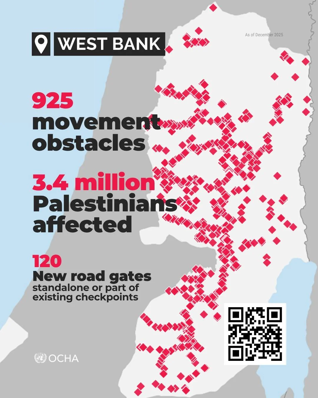
We have now released a new fact sheet and an updated version of the West Bank Access Restrictions Map, based on a comprehensive field survey carried out in December 2025.
The key findings include:
925 obstacles across the West Bank (the highest number on a 20-year record)
At least 459 obstacles block or hinder access to main roads
Over 120 new road gates installed in 2025 (standalone or as part of checkpoints)
The 712-km-long Barrier (64% built) remains the single largest obstacle
👥︎ 3.4 million Palestinians affected
Through the interactive map, you can zoom into specific areas, display layers of your choice, and export customized, printable versions.
Links:
Fact sheet: https://www.ochaopt.org/.../movement-and-access-west-bank...
West Bank poster-size map (PDF): https://www.ochaopt.org/.../west-bank-access-restrictions...
Interactive map: https://bit.ly/OPT-Map-2026